Guide
 Variety of Earth Observation Satellite Image-Acquisition Modes
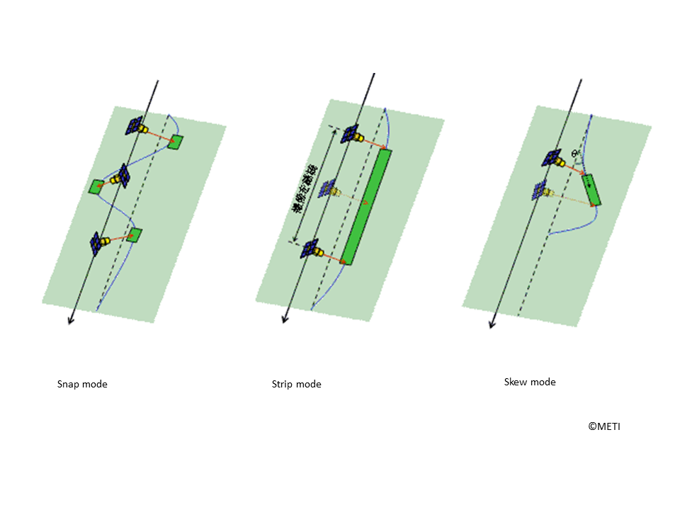
Each earth observation satellite has several image acquisition modes.
In this article some typical modes are presented.
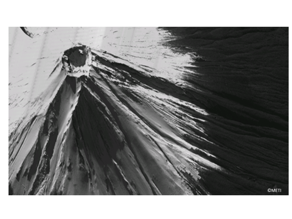
First example is the Snap mode from an oblique direction.
It shows the Japanese highest mountain, Mt. Fuji.
We can recognize the highest and mountain side view.
The center hole is "Okama" or the volcanic crater of 800m radius and 200m depth.
(Note : This image is processed for web display use.)
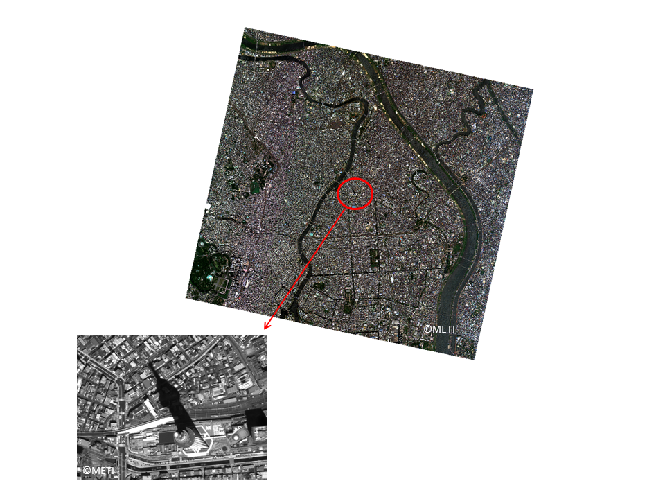
The second example is Tokyo with nadir Snap image.
Very complicated mega city Tokyo is shown with several rivers and many roads.
In the red circle center the Tokyo Skytree is located.
The left bottom enlarged view well indicates the height of the Tokyo Skytree by its long shadow.
(Note : This image is processed for web display use.)
These are examples of Snap mode.
This mode is a nominal, main use mode.
Other modes are used for satellite imaging as follows.
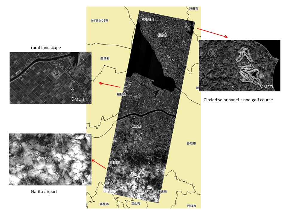
The third example is Strip mode.
This mode takes long nadir image along the orbit.
This example is an image from Ibaraki prefecture to Chiba prefecture over 40km long.
Each part is precise same as Snap mode.
In the north, there is a golf course and in the south, the Narita airport beneath the clouds.
At lakeside, nice looking rural landscape with high voltage power lines.
Strip mode is used to take image of long area, such as long seashore, and long rail road, long pipe line, etc.
(Note : This image is processed for web display use.)
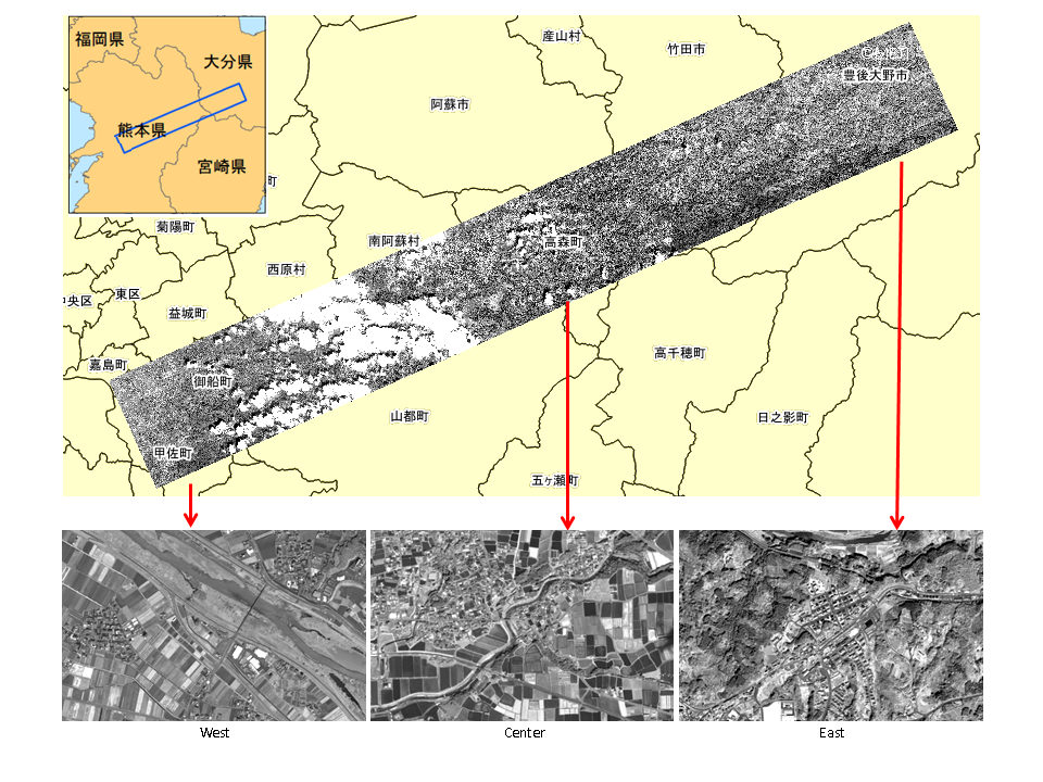
The fourth example is Skew mode.
Same as Strip mode it is used to take image of long landscape not along the orbit but lateral or skew.
This example shows almost 80km long image from Bungotakada city of Oita prefecture to Uto city of Kumamoto prefecture.
This area is spotlightened after the 2016 April Kumamoto earthquake as the Nudagawa active - fault line.
(Note : This image is processed for web display use.)
These images were taken by ASNARO-1 on the following dates and processed for web display use :
First example : December 22, 2016
Second example : August 8, 2015
Third example : January 24, 2015
Fourth example : April 17, 2016
(Note) The images in this article are based on the results of outsourcing projects of the Ministry of Economy, Trade and Industry.
ASNARO-1 : http://www.jspacesystems.or.jp/en_project_asnaro/
Courtesy of METI : http://www.meti.go.jp/policy/mono_info_service/mono/space_industry/


